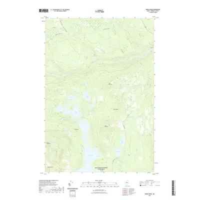
2021 Map of Pierce Pond
USGS Topo · Published 2021About this map
The Dead River snakes through the northern Maine woods, carving a deep valley beneath the slopes of Dead River Mtn and Black Nubble. This Somerset County landscape is defined by its intricate network of interconnected glacial lakes and high-elevation ponds. The central feature, Pierce Pond, is fed by several smaller bodies of water including Upper Pierce Pond and Split Rock Pond, which are linked by the narrow channel known as The Thoroughfare.
Find a feature on this map
43 named features on this map. Tap any name to fly to it.
Don’t see what you’re looking for? This feature index may not catch every label — zoom into the map to look around manually.
Map Details
Editions of this 2021 Pierce Pond Map
This is the sole edition of this map. No revisions or reprints were ever made.
Other maps of this area

1903 · Bingham
USGS Topo · 1:62,500

1905 · Bingham
USGS Topo · 1:62,500

1905 · The Forks
USGS Topo · 1:62,500

1907 · The Forks
USGS Topo · 1:62,500

1925 · Pierce Pond
USGS Topo · 1:48,000

1927 · Pierce Pond
USGS Topo · 1:62,500

1928 · Dead River
USGS Topo · 1:62,500

1931 · Dead River
USGS Topo · 1:48,000

1944 · Dead River
USGS Topo · 1:62,500

1944 · Pierce Pond
USGS Topo · 1:62,500
Featured Places
- West Forks, ME
- Bowtown Township, ME
- Pierce Pond Township, ME
- Lower Enchanted Township, ME
- Somerset County, ME