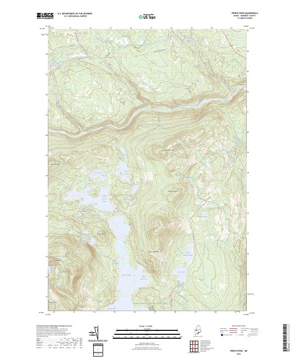
2024 Map of Pierce Pond
USGS Topo · Published 2024About this map
The Appalachian National Scenic Trail traverses the southern edge of this Somerset County landscape, skirting the lower reaches of Pierce Pond. This region is defined by an intricate network of waterways and elevated ridges, where the Dead River flows through the northern section, fed by the Gulf Stream and Enchanted Stream. The terrain is punctuated by significant peaks like Dead River Mtn and Otter Pond Mtn, which frame a series of remote water bodies including Upper Kilgore Pond and Split Rock Pond. Connectivity in this wooded territory relies on a system of unpaved tracks such as Lower Enchanted Rd and Bowtown Rd, reflecting a landscape dedicated to timber management and wilderness recreation. Strategic points like The Thoroughfare and Caribou Narrows illustrate the complex hydrography that has shaped movement through the area for generations.
Find a feature on this map
46 named features on this map. Tap any name to fly to it.
Don’t see what you’re looking for? This feature index may not catch every label — zoom into the map to look around manually.
Map Details
Editions of this 2024 Pierce Pond Map
This is the sole edition of this map. No revisions or reprints were ever made.
Other maps of this area

1903 · Bingham
USGS Topo · 1:62,500

1905 · Bingham
USGS Topo · 1:62,500

1905 · The Forks
USGS Topo · 1:62,500

1907 · The Forks
USGS Topo · 1:62,500

1925 · Pierce Pond
USGS Topo · 1:48,000

1927 · Pierce Pond
USGS Topo · 1:62,500

1928 · Dead River
USGS Topo · 1:62,500

1931 · Dead River
USGS Topo · 1:48,000

1944 · Dead River
USGS Topo · 1:62,500

1944 · Pierce Pond
USGS Topo · 1:62,500
Featured Places
- West Forks, ME
- Bowtown Township, ME
- Pierce Pond Township, ME
- Lower Enchanted Township, ME
- Somerset County, ME