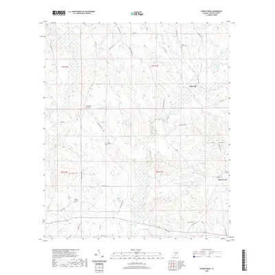
2020 Map of Pigeon Creek
USGS Topo · Published 2020About this map
Pigeon Creek and its many tributaries, including Hard Labor Cr and Orange Br, define the landscape of this rural Butler County region. The namesake settlement of Pigeon Creek sits in the eastern portion of the quadrangle, while Halso Mill serves as a reminder of early water-powered industry along the creek banks. The map documents a high density of rural burial grounds, such as Mount Carmel Cem and Ebenezer Cem, which are invaluable for genealogical research and locating family homesteads.
Find a feature on this map
49 named features on this map. Tap any name to fly to it.
Don’t see what you’re looking for? This feature index may not catch every label — zoom into the map to look around manually.
Map Details
Editions of this 2020 Pigeon Creek Map
This is the sole edition of this map. No revisions or reprints were ever made.
Other maps of this area

1953 · Andalusia
USGS Topo · 1:250,000

1957 · Andalusia
USGS Topo · 1:250,000

1971 · Industry
USGS Topo · 1:24,000

1971 · Greenville West
USGS Topo · 1:24,000

1971 · Pigeon Creek
USGS Topo · 1:24,000

1971 · Mc Kenzie
USGS Topo · 1:24,000

1971 · Honoraville
USGS Topo · 1:24,000

1971 · Leon
USGS Topo · 1:24,000

1971 · Moodys Crossroads
USGS Topo · 1:24,000

1971 · Greenville East
USGS Topo · 1:24,000