
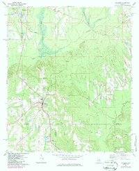
1971 Map of Mc Kenzie
USGS Topo · Published 1973About this map
Mc Kenzie serves as a central hub in this early 1970s landscape, where the Louisville and Nashville railroad cuts a diagonal path through south-central Alabama. The map documents a dense network of country churches and small family landmarks, including Olive Branch Ch, Kokomo Ch, and Welcome Ch, illustrating the social fabric of the rural communities surrounding Georgiana.
Find a feature on this map
33 named features on this map. Tap any name to fly to it.
Don’t see what you’re looking for? This feature index may not catch every label — zoom into the map to look around manually.
Map Details
Editions of this 1971 Mc Kenzie Map
2 editions found
Other maps of this area

1953 · Andalusia
USGS Topo · 1:250,000

1957 · Andalusia
USGS Topo · 1:250,000

1971 · Brooks
USGS Topo · 1:24,000

1971 · Industry
USGS Topo · 1:24,000

1971 · Pigeon Creek
USGS Topo · 1:24,000

1971 · Red Level
USGS Topo · 1:24,000

1971 · Georgiana East
USGS Topo · 1:24,000

1971 · Garland
USGS Topo · 1:24,000

1971 · Georgiana West
USGS Topo · 1:24,000

1982 · Old Town
USGS Topo · 1:24,000