
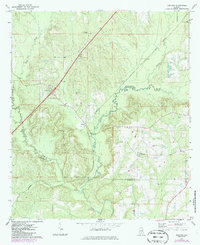
1971 Map of Garland
USGS Topo · Published 1974About this map
Garland and the surrounding rural communities of Butler and Conecuh Counties are captured here in the early 1970s, defined by the winding course of the Sepulga River and its many tributaries. The area's social fabric is anchored by numerous small country churches and cemeteries, including St John Ch, Belmont No 2 Ch, and Long Creek Temple. The Louisville and Nashville railroad cuts a diagonal line through the northern half of the landscape, bypassing the village of Garland and Mt Olive. High ground in the eastern portion of the map is marked by Odom Crossroads and several family-named landmarks like Sellers Cem. This survey illustrates the persistent agricultural and timber-driven character of the Alabama coastal plain before modern development patterns fully altered the traditional settlement footprints of small hamlets like these.
Find a feature on this map
20 named features on this map. Tap any name to fly to it.
Don’t see what you’re looking for? This feature index may not catch every label — zoom into the map to look around manually.
Map Details
Editions of this 1971 Garland Map
2 editions found
Other maps of this area

1953 · Andalusia
USGS Topo · 1:250,000

1957 · Andalusia
USGS Topo · 1:250,000

1971 · Lyeffion
USGS Topo · 1:24,000

1971 · Brooks
USGS Topo · 1:24,000

1971 · Mc Kenzie
USGS Topo · 1:24,000

1971 · Georgiana East
USGS Topo · 1:24,000

1971 · Bethel
USGS Topo · 1:24,000

1971 · Georgiana West
USGS Topo · 1:24,000

1982 · Evergreen
USGS Topo · 1:24,000

1982 · Old Town
USGS Topo · 1:24,000