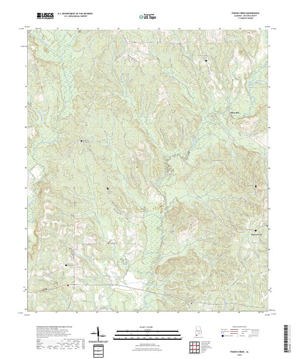
2024 Map of Pigeon Creek
USGS Topo · Published 2024About this map
Pigeon Creek winds through the heart of this Butler County landscape, feeding the extensive Pigeon Creek Swamp in the northeast and defining the local drainage system alongside tributaries like Hard Labor Creek and Flat Branch. The settlement pattern is characterized by scattered family and community centers, notably Halso Mill and the small concentration at Pigeon Creek. The map serves as a detailed record for genealogists, documenting numerous burial sites across the township lines including Mount Carmel Cem, Sardis Cem, and Ebenezer Cem. A network of rural routes such as Hugely Bridge Rd and New Prospect Rd connects these points of interest, following the natural contours of the hills and creek bottoms in a region where timber and small-scale agriculture traditionally shaped the landscape.
Find a feature on this map
57 named features on this map. Tap any name to fly to it.
Don’t see what you’re looking for? This feature index may not catch every label — zoom into the map to look around manually.
Map Details
Editions of this 2024 Pigeon Creek Map
This is the sole edition of this map. No revisions or reprints were ever made.
Other maps of this area

1953 · Andalusia
USGS Topo · 1:250,000

1957 · Andalusia
USGS Topo · 1:250,000

1971 · Industry
USGS Topo · 1:24,000

1971 · Greenville West
USGS Topo · 1:24,000

1971 · Pigeon Creek
USGS Topo · 1:24,000

1971 · Mc Kenzie
USGS Topo · 1:24,000

1971 · Honoraville
USGS Topo · 1:24,000

1971 · Leon
USGS Topo · 1:24,000

1971 · Moodys Crossroads
USGS Topo · 1:24,000

1971 · Greenville East
USGS Topo · 1:24,000