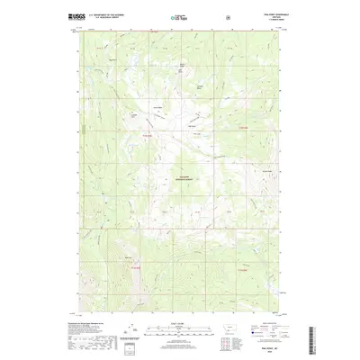
2020 Map of Pika Point
USGS Topo · Published 2020About this map
Gallatin National Forest dominates this high-altitude landscape along the border of Madison and Gallatin counties. The terrain is defined by a series of prominent divides and basins, most notably the Carrot Basin and its accompanying Carrot Basin Divide, which separate the drainages of Wapiti Creek and Sage Creek. The map documents a complex hydrological network of alpine lakes, including the uniquely named Axolotl Lake, Lomna Lake, and Turquoise Lake. Significant topographical features like Wapiti Ridge and Pika Point rise above the deep valleys of Sunlight Basin and Sage Basin. Human presence is minimal, marked primarily by the Kirkwood area in the southeast and an isolated Oil Well near Upper Sage Creek, indicating sparse resource extraction within the protected forest lands. The presence of Potamogeton Park and various creek systems like Red Cub and Timber Creek suggests a high-mountain environment preserved for wilderness and watershed values.
Find a feature on this map
60 named features on this map. Tap any name to fly to it.
Don’t see what you’re looking for? This feature index may not catch every label — zoom into the map to look around manually.
Map Details
Editions of this 2020 Pika Point Map
This is the sole edition of this map. No revisions or reprints were ever made.
Other maps of this area

1888 · Three Forks
USGS Topo · 1:250,000

1894 · Three Forks
USGS Topo · 1:250,000

1895 · Three Forks
USGS Topo · 1:250,000

1947 · Bozeman
USGS Topo · 1:250,000

1948 · Bozeman
USGS Topo · 1:250,000

1950 · Hebgen Dam
USGS Topo · 1:62,500

1950 · Sphinx Mountain
USGS Topo · 1:62,500

1955 · Bozeman
USGS Topo · 1:250,000

1955 · Crown Butte
USGS Topo · 1:62,500

1955 · Ashton
USGS Topo · 1:250,000