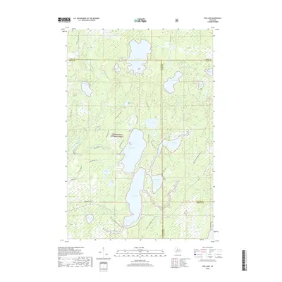
2018 Map of Pike Lake
USGS Topo · Published 2018About this map
Chequamegon National Forest encompasses the vast majority of this landscape, where a dense network of glacial lakes and wetlands forms the headwaters for local drainage systems. Dominating the central area is the expansive Round Lake, connected via a narrow channel to Pike Lake further south. The South Fork Flambeau River winds through the western portion of the map, passing the distinct landform of River Saddle.
Find a feature on this map
53 named features on this map. Tap any name to fly to it.
Don’t see what you’re looking for? This feature index may not catch every label — zoom into the map to look around manually.
Map Details
Editions of this 2018 Pike Lake Map
This is the sole edition of this map. No revisions or reprints were ever made.
Other maps of this area

1938 · Lac Du Flambeau
USGS Topo · 1:48,000

1939 · Lac Du Flambeau
USGS Topo · 1:48,000

1939 · Winchester
USGS Topo · 1:48,000

1940 · Mercer
USGS Topo · 1:48,000

1941 · Pike Lake
USGS Topo · 1:48,000

1942 · Pike Lake
USGS Topo · 1:48,000

1945 · Mercer
USGS Topo · 1:48,000

1946 · Winchester
USGS Topo · 1:48,000

1946 · Lac Du Flambeau
USGS Topo · 1:48,000

1947 · Mercer
USGS Topo · 1:48,000