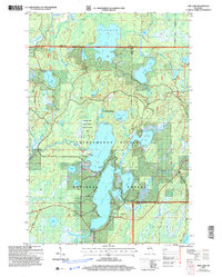
2005 Map of Pike Lake
USGS Topo · Published 2006About this map
The Chequamegon-Nicolet National Forest dominates this landscape, where the waters of Pike Lake and Round Lake meet at the boundary of Price and Vilas counties. This northern Wisconsin woodland, as documented in 2005, is defined by an intricate network of glacial lakes and wetlands, including the dedicated Mac Kinnsy Slough Wetland Habitat Area. The presence of the Round Lake Semi-Primitive Non Motorized Area suggests a commitment to preserving the quiet character of the region, emphasizing recreation through numerous boat ramps and carry-in access points.
Find a feature on this map
46 named features on this map. Tap any name to fly to it.
Don’t see what you’re looking for? This feature index may not catch every label — zoom into the map to look around manually.
Map Details
Editions of this 2005 Pike Lake Map
This is the sole edition of this map. No revisions or reprints were ever made.
Other maps of this area

1938 · Lac Du Flambeau
USGS Topo · 1:48,000

1939 · Lac Du Flambeau
USGS Topo · 1:48,000

1939 · Winchester
USGS Topo · 1:48,000

1940 · Mercer
USGS Topo · 1:48,000

1941 · Pike Lake
USGS Topo · 1:48,000

1942 · Pike Lake
USGS Topo · 1:48,000

1945 · Mercer
USGS Topo · 1:48,000

1946 · Winchester
USGS Topo · 1:48,000

1946 · Lac Du Flambeau
USGS Topo · 1:48,000

1947 · Mercer
USGS Topo · 1:48,000