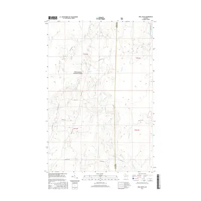
2015 Map of Pike Lake SE
USGS Topo · Published 2015About this map
Chequamegon National Forest defines the wooded character of this Northwoods landscape, where the boundary between Price and Oneida counties splits a dense network of water resources. The upper reaches of the Willow River dominate the eastern half of the terrain, fed by numerous natural features such as Willow Springs and Little Willow Cr. To the north, Squaw Lake serves as a prominent landmark on the edge of the forest, while the southwestern portion is marked by Grant Spring and Spring Cr.
Find a feature on this map
28 named features on this map. Tap any name to fly to it.
Don’t see what you’re looking for? This feature index may not catch every label — zoom into the map to look around manually.
Map Details
Editions of this 2015 Pike Lake SE Map
This is the sole edition of this map. No revisions or reprints were ever made.
Other maps of this area

1938 · Lac Du Flambeau
USGS Topo · 1:48,000

1939 · Lac Du Flambeau
USGS Topo · 1:48,000

1939 · Mc Cord
USGS Topo · 1:48,000

1941 · Pike Lake
USGS Topo · 1:48,000

1941 · Brantwood
USGS Topo · 1:48,000

1942 · Pike Lake
USGS Topo · 1:48,000

1943 · Brantwood
USGS Topo · 1:48,000

1946 · Lac Du Flambeau
USGS Topo · 1:48,000

1947 · Mc Cord
USGS Topo · 1:48,000

1950 · Pike Lake
USGS Topo · 1:48,000