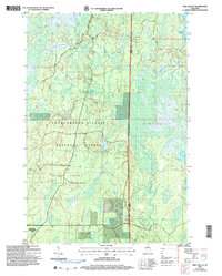
2005 Map of Pike Lake SE
USGS Topo · Published 2006About this map
The Chequamegon-Nicolet National Forest dominates this landscape in northern Wisconsin, straddling the border between Price and Oneida counties. This 2005 revision detail the terrain of the Fifield, Emery, and Minocqua areas, where a complex network of wetlands and creeks defines the hydrology. Water sources are particularly prominent, ranging from the large Squaw Lake and Bootjack Lake to smaller named springs like Grant Spring, Willow Springs, and Sieverson Spring.
Find a feature on this map
20 named features on this map. Tap any name to fly to it.
Don’t see what you’re looking for? This feature index may not catch every label — zoom into the map to look around manually.
Map Details
Editions of this 2005 Pike Lake SE Map
This is the sole edition of this map. No revisions or reprints were ever made.
Other maps of this area

1938 · Lac Du Flambeau
USGS Topo · 1:48,000

1939 · Lac Du Flambeau
USGS Topo · 1:48,000

1939 · Mc Cord
USGS Topo · 1:48,000

1941 · Pike Lake
USGS Topo · 1:48,000

1941 · Brantwood
USGS Topo · 1:48,000

1942 · Pike Lake
USGS Topo · 1:48,000

1943 · Brantwood
USGS Topo · 1:48,000

1946 · Lac Du Flambeau
USGS Topo · 1:48,000

1947 · Mc Cord
USGS Topo · 1:48,000

1950 · Pike Lake
USGS Topo · 1:48,000