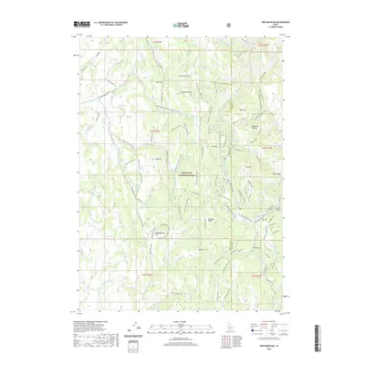
2020 Map of Pike Mountain
USGS Topo · Published 2020About this map
Sawtooth National Forest dominates this high-elevation landscape along the border of Twin Falls and Cassia counties. The area is defined by a dense network of seasonal access routes including the Wagonwheel Springs Loop and the Rock Creek Loop, reflecting the region's heavy reliance on winter recreation and forest management. Dozens of named water sources such as McConnell Spring, Shoshone Spring, and Sanitary Spring are scattered across the high ridges, providing essential water in an otherwise arid environment. Notable summits like Pike Mountain and Black Mtn stand above deep drainages like Wahlstrom Hollow. The topography includes distinctive level areas such as Thoroughbred Flat and Langford Flat, which offer rare breaks in the elevation between Deadline Ridge and the various forks of Shoshone Creek.
Find a feature on this map
112 named features on this map. Tap any name to fly to it.
Don’t see what you’re looking for? This feature index may not catch every label — zoom into the map to look around manually.
Map Details
Editions of this 2020 Pike Mountain Map
This is the sole edition of this map. No revisions or reprints were ever made.
Other maps of this area

1955 · Twin Falls
USGS Topo · 1:250,000

1958 · Twin Falls
USGS Topo · 1:250,000

1965 · Rams Horn Ridge
USGS Topo · 1:24,000

1965 · Grand View Peak
USGS Topo · 1:24,000

1965 · Mc Mullen Basin
USGS Topo · 1:24,000

1977 · Timber Butte
USGS Topo · 1:24,000

1977 · Big Creek Ranch
USGS Topo · 1:24,000

1977 · Mahogany Butte
USGS Topo · 1:24,000

1978 · Hopper Gulch
USGS Topo · 1:24,000
1978 · Pike Mountain
USGS Topo · 1:24,000