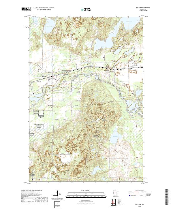
2022 Map of Pillager
USGS Topo · Published 2022About this map
The Crow Wing River winds across this central Minnesota landscape, defining the character of the settlements at Pillager and Sylvan. The river's path is joined by several local water bodies including Rice Lake, Pillager Lake, and Lake Placid, reflecting a terrain shaped by post-glacial hydrology and modern drainage patterns. The area maintains a high concentration of localized historical sites, particularly evident in the numerous small burial grounds such as Wildwood Cem, Pillager Cem, and the Franzen Family Cem.
Find a feature on this map
81 named features on this map. Tap any name to fly to it.
Don’t see what you’re looking for? This feature index may not catch every label — zoom into the map to look around manually.
Map Details
Editions of this 2022 Pillager Map
This is the sole edition of this map. No revisions or reprints were ever made.
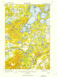
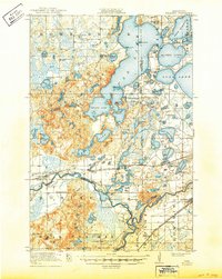
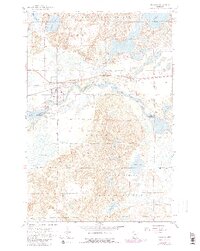
Historical Maps of Pillager Through Time
4 maps found