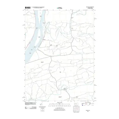
2010 Map of Pillow
USGS Topo · Published 2010About this map
Herndon sits along the eastern bank of the Susquehanna River in this 2010 topographic record, overlooking a complex of river features including Hoover Island, Bowers Island, and Blood Island. The landscape transitions from the river flats toward the significant elevations of Hooflander Mountain and Mahantango Mountain, with the settlement of Pillow located near the southern border along Mahantango Creek. The geography is defined by numerous watercourses such as Mahanoy Creek, Schwaben Creek, and Fidlers Run that carve through the ridges. Cultural and genealogical markers are visible across the rural terrain, including Saint Johns Cemetery, Gods Missionary Cemetery, and the Camp Meeting Grove. Historical transport and local routes like Tulpehoken Path Rd and Railway St reflect the long-standing infrastructure connecting these Susquehanna Valley communities.
Find a feature on this map
56 named features on this map. Tap any name to fly to it.
Don’t see what you’re looking for? This feature index may not catch every label — zoom into the map to look around manually.
Map Details
Editions of this 2010 Pillow Map
This is the sole edition of this map. No revisions or reprints were ever made.
Other maps of this area

1892 · Lykens
USGS Topo · 1:62,500

1892 · Shamokin
USGS Topo · 1:62,500

1893 · Sunbury
USGS Topo · 1:62,500

1893 · Lykens
USGS Topo · 1:62,500

1893 · Shamokin
USGS Topo · 1:62,500

1893 · Millersburg
USGS Topo · 1:62,500

1943 · Millersburg
USGS Topo · 1:62,500

1943 · Lykens
USGS Topo · 1:62,500

1943 · Shamokin
USGS Topo · 1:62,500

1943 · Sunbury
USGS Topo · 1:62,500