Loading...
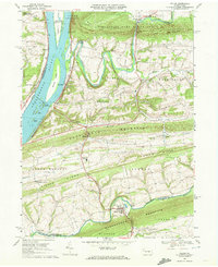
Loading map...1969 Map of Pillow
USGS Topo · Published 1972About this map
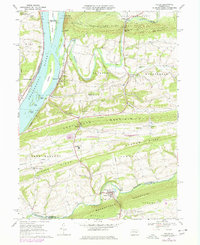
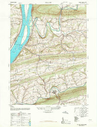
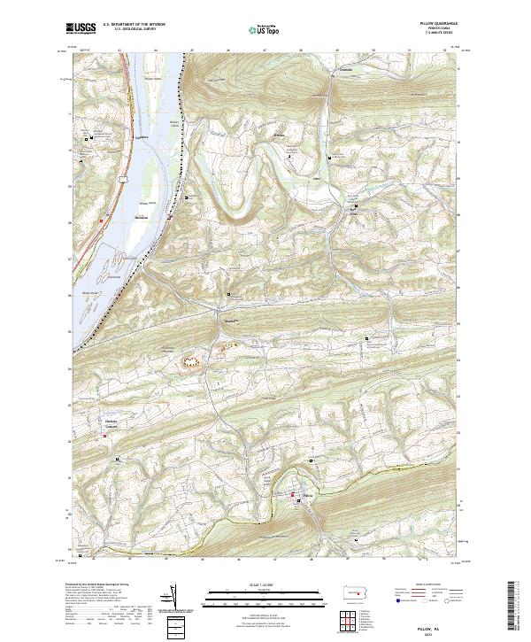
The Susquehanna River defines the western edge of this central Pennsylvania landscape, where numerous river features like Hoover Island, Whites Island, and Carls Island create a complex channel system. Inland, the topography is governed by a series of parallel ridges, including Fisher Ridge and Line Mountain, which channel the flow of the Mahanoy Creek and its tributaries. The settlement pattern follows these natural corridors, with villages like Dalmatia and Hickory Corners situated along the lower slopes and valleys.
Find a feature on this map
64 named features on this map. Tap any name to fly to it.
Don’t see what you’re looking for? This feature index may not catch every label — zoom into the map to look around manually.
Map Details
Date Portrayed1969
Date Published1972
PublisherU.S. Geological Survey
Map TypeTopographic
Scale1:24,000
Physical Dimensions22.1 x 27 inches
Editions of this 1969 Pillow Map
2 editions found
Historical Maps of Herndon Through Time
7 maps found


Featured Locations
Source Details
SourceU.S. Geological Survey
CopyrightPublic Domain