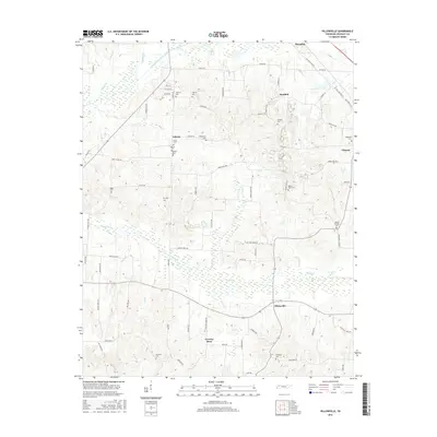
2016 Map of Pillowville
USGS Topo · Published 2016About this map
Pillowville and the surrounding rural communities of Liberty and Sandhill define this portion of Weakley County, where small settlements are connected by a dense network of country roads. The landscape is deeply carved by watercourses such as Cane Cr, Cotton Cr, and Spring Cr, which drain northward toward the Middle Fork Obion River. This drainage pattern influenced the placement of early homesteads and cemeteries on the higher ground between the creek bottoms.
Find a feature on this map
80 named features on this map. Tap any name to fly to it.
Don’t see what you’re looking for? This feature index may not catch every label — zoom into the map to look around manually.
Map Details
Editions of this 2016 Pillowville Map
This is the sole edition of this map. No revisions or reprints were ever made.
Other maps of this area

1950 · Martin
USGS Topo · 1:24,000

1952 · Dresden
USGS Topo · 1:24,000

1954 · Greenfield
USGS Topo · 1:24,000

1954 · Bradford
USGS Topo · 1:24,000

1956 · Dyersburg
USGS Topo · 1:250,000

1957 · Como
USGS Topo · 1:24,000

1966 · Trezevant West
USGS Topo · 1:24,000

1967 · Pillowville
USGS Topo · 1:24,000
1967 · Trezevant East
USGS Topo · 1:24,000
1967 · Mc Kenzie
USGS Topo · 1:24,000