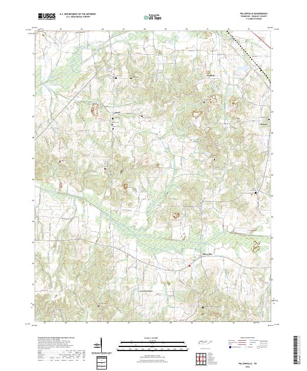
2022 Map of Pillowville
USGS Topo · Published 2022About this map
The Middle Fork Obion River meanders across the northern reaches of this Weakley County landscape, anchoring a network of creek bottoms including Cane Cr and Spring Cr. The settlement pattern here reflects a deep agricultural history, with rural hubs like Pillowville and Liberty connected by a web of local roads and family-named routes such as Moran Rd and Wards Chapel Rd. Genealogists will find a high density of burial sites scattered throughout the terrain, ranging from the Liberty Cem near the river to the isolated Higgs Cem and Seminary Cem. At Crowley Store, the intersection of local routes illustrates the small-scale commerce that sustained these Tennessee communities into the modern era, while the eastern edge of the map reaches toward the edge of Gleason.
Find a feature on this map
80 named features on this map. Tap any name to fly to it.
Don’t see what you’re looking for? This feature index may not catch every label — zoom into the map to look around manually.
Map Details
Editions of this 2022 Pillowville Map
This is the sole edition of this map. No revisions or reprints were ever made.
Other maps of this area

1950 · Martin
USGS Topo · 1:24,000

1952 · Dresden
USGS Topo · 1:24,000

1954 · Greenfield
USGS Topo · 1:24,000

1954 · Bradford
USGS Topo · 1:24,000

1956 · Dyersburg
USGS Topo · 1:250,000

1957 · Como
USGS Topo · 1:24,000

1966 · Trezevant West
USGS Topo · 1:24,000

1967 · Pillowville
USGS Topo · 1:24,000
1967 · Trezevant East
USGS Topo · 1:24,000
1967 · Mc Kenzie
USGS Topo · 1:24,000