
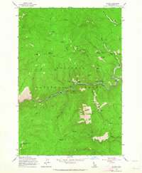
1995 Map of Pilot Knob
USGS Topo · Published 1999About this map
The Nez Perce National Forest landscape shown here reflects a long history of resource extraction and mountain travel in central Idaho. At the summit of Pilot Knob, a prominent lookout and Electronic Site overlook the drainages of Newsome Creek and the Red River. The map documents the physical remnants of the region's mining heritage, specifically along the watercourses where Dredge Tailings and the Pell Placer Mine are located near the eastern edge of the quadrangle.
Find a feature on this map
56 named features on this map. Tap any name to fly to it.
Don’t see what you’re looking for? This feature index may not catch every label — zoom into the map to look around manually.
Map Details
Editions of this 1995 Pilot Knob Map
This is the sole edition of this map. No revisions or reprints were ever made.
Other maps of this area
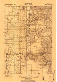
1924 · Weippe
USGS Topo · 1:125,000

1931 · Buffalo Hump
USGS Topo · 1:125,000

1934 · Buffalo Hump
USGS Topo · 1:125,000

1956 · Elk City
USGS Topo · 1:250,000

1956 · Hamilton
USGS Topo · 1:250,000

1959 · Hamilton
USGS Topo · 1:250,000

1960 · Elk City
USGS Topo · 1:250,000

1960 · Hamilton
USGS Topo · 1:250,000
1962 · Golden
USGS Topo · 1:24,000
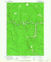
1962 · Center Star Mtn
USGS Topo · 1:24,000