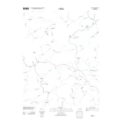
2013 Map of Pilot
USGS Topo · Published 2013About this map
Huffville and Pilot anchor a landscape defined by the branching tributaries of the S Fork Roanoke River and Brush Cr. This 2013 survey documents a network of small upland settlements including Basham, Terrys Fork, and Tindall, connected by narrow roads that wind through the Blue Ridge terrain. The map's labeling reveals a deeply personal topography of family-named landmarks and secluded gaps, such as Booth Hollow, Panther Hollow, and Texas Hollow. Prominent elevations like Fishers View Mountain and Coles Knob overlook the diverse drainage patterns of Elliott Cr and Purgatory Cr. The spatial arrangement of these hollows and ridges illustrates the traditional Appalachian settlement pattern where housing and transport naturally follow the narrow valley floors and creek beds.
Find a feature on this map
113 named features on this map. Tap any name to fly to it.
Don’t see what you’re looking for? This feature index may not catch every label — zoom into the map to look around manually.
Map Details
Editions of this 2013 Pilot Map
This is the sole edition of this map. No revisions or reprints were ever made.
Other maps of this area

1890 · Christiansburg
USGS Topo · 1:125,000

1932 · Blacksburg
USGS Topo · 1:48,000

1937 · Blacksburg
USGS Topo · 1:62,500

1950 · Elliston
USGS Topo · 1:62,500

1953 · Winston-Salem
USGS Topo · 1:250,000

1955 · Bluefield
USGS Topo · 1:250,000

1955 · Winston-Salem
USGS Topo · 1:250,000

1957 · Endicott
USGS Topo · 1:62,500

1957 · Floyd
USGS Topo · 1:62,500

1957 · Bluefield
USGS Topo · 1:250,000