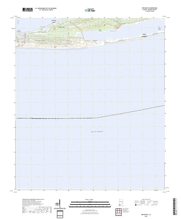
2025 Map of Pine Beach
USGS Topo · Published 2025About this map
Fort Morgan Peninsula stretches between the open waters of the Gulf of America and the sheltered reaches of Bon Secour Bay. This coastal landscape is defined by the narrow strip of land separating Little Lagoon from the sea, where modern infrastructure like W Beach Blvd and Fort Morgan Rd provides access to settlements such as Gulf Shores and Palmetto Beach.
Find a feature on this map
25 named features on this map. Tap any name to fly to it.
Don’t see what you’re looking for? This feature index may not catch every label — zoom into the map to look around manually.
Map Details
Editions of this 2025 Pine Beach Map
This is the sole edition of this map. No revisions or reprints were ever made.
Other maps of this area

1921 · Bon Secour
USGS Topo · 1:62,500

1921 · Point Clear
USGS Topo · 1:62,500

1941 · Foley
USGS Topo · 1:62,500

1941 · Weeks Bay
USGS Topo · 1:62,500

1943 · Weeks Bay
USGS Topo · 1:62,500

1943 · Foley
USGS Topo · 1:62,500

1957 · Pensacola
USGS Topo · 1:250,000

1959 · Pensacola
USGS Topo · 1:250,000

1960 · Pensacola
USGS Topo · 1:250,000
1978 · Pensacola
USGS Topo · 1:100,000