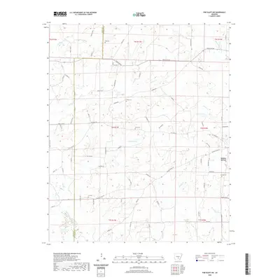
2020 Map of Pine Bluff NW
USGS Topo · Published 2020About this map
Sulphur Springs sits at the eastern edge of this Jefferson County landscape, where the terrain is defined by a dense network of winding creeks and small family cemeteries. The mapping of Fitzhugh Cem, Branch Cem, and Lee Cem across the countryside suggests a long-established rural community structure. Much of the local geography is shaped by the presence of Bayou Bartholomew and the intricate drainage of Johnson Cr and Allgood Cr. The inclusion of the Old Tram Rd indicates the area's history with resource transport or early timbering, while Princeton Pike serves as a primary corridor through the rolling woodlands. Other notable landmarks including Robinson Lake and Ta-Lo-Ha-Lake offer insight into the local water management and recreational landscape during the early 21st century.
Find a feature on this map
80 named features on this map. Tap any name to fly to it.
Don’t see what you’re looking for? This feature index may not catch every label — zoom into the map to look around manually.
Map Details
Editions of this 2020 Pine Bluff NW Map
This is the sole edition of this map. No revisions or reprints were ever made.
Other maps of this area

1932 · Pastoria
USGS Topo · 1:62,500

1935 · Pastoria
USGS Topo · 1:62,500

1955 · Little Rock
USGS Topo · 1:250,000

1956 · Little Rock
USGS Topo · 1:250,000

1960 · Little Rock
USGS Topo · 1:250,000

1962 · Pine Bluff
USGS Topo · 1:24,000

1962 · Faith
USGS Topo · 1:24,000

1962 · Pine Bluff NW
USGS Topo · 1:24,000

1962 · Kedron
USGS Topo · 1:24,000

1964 · Little Rock
USGS Topo · 1:250,000