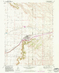
1992 Map of Pine Bluffs
USGS Topo · Published 1995About this map
Pine Bluffs serves as the focal point of this high-plains landscape, situated where the state lines of Wyoming and Nebraska meet. The settlement is defined by its transit and civic infrastructure, including the High Sch, a Cem, and the nearby Rodeo Ground. This 1990s record captures the region's ranching and utility character, showing a network of irrigation and transport including the Wisroth Reservoir and a significant Pipeline corridor.
Find a feature on this map
22 named features on this map. Tap any name to fly to it.
Don’t see what you’re looking for? This feature index may not catch every label — zoom into the map to look around manually.
Map Details
Editions of this 1992 Pine Bluffs Map
This is the sole edition of this map. No revisions or reprints were ever made.
Other maps of this area

1954 · Scottsbluff
USGS Topo · 1:250,000

1954 · Cheyenne
USGS Topo · 1:250,000

1958 · Cheyenne
USGS Topo · 1:250,000

1958 · Scottsbluff
USGS Topo · 1:250,000

1963 · Pine Bluffs
USGS Topo · 1:24,000

1963 · Lindbergh
USGS Topo · 1:24,000

1963 · Pine Bluffs SE
USGS Topo · 1:24,000

1963 · Pine Bluffs SW
USGS Topo · 1:24,000

1963 · Tracy
USGS Topo · 1:24,000

1968 · Pine Bluffs
USGS Topo · 1:24,000