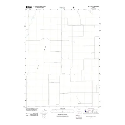
2011 Map of Pine Bluffs SE
USGS Topo · Published 2011About this map
Pine Bluffs define the northwestern horizon of this Weld County landscape, where the high plains of Colorado meet the Wyoming border. The terrain is marked by the prominence of Panorama Point, situated near the convergence of several rural routes including County Rd-200 and County Rd-5. Water is a scarce but vital element in this arid environment, represented by the ephemeral Muddy Creek and Spring Creek in the north, along with the Culek Dam catchment. The map reveals a strictly regulated township and range grid system, with a network of numbered county roads such as County Rd-161 and County Rd-208 facilitating the agricultural and ranching operations that characterize this borderland region in the early 21st century.
Find a feature on this map
21 named features on this map. Tap any name to fly to it.
Don’t see what you’re looking for? This feature index may not catch every label — zoom into the map to look around manually.
Map Details
Editions of this 2011 Pine Bluffs SE Map
This is the sole edition of this map. No revisions or reprints were ever made.
Other maps of this area

1954 · Sterling
USGS Topo · 1:250,000

1954 · Scottsbluff
USGS Topo · 1:250,000

1954 · Cheyenne
USGS Topo · 1:250,000

1954 · Greeley
USGS Topo · 1:250,000

1957 · Greeley
USGS Topo · 1:250,000

1958 · Cheyenne
USGS Topo · 1:250,000

1958 · Greeley
USGS Topo · 1:250,000

1958 · Scottsbluff
USGS Topo · 1:250,000

1958 · Sterling
USGS Topo · 1:250,000

1961 · Greeley
USGS Topo · 1:250,000