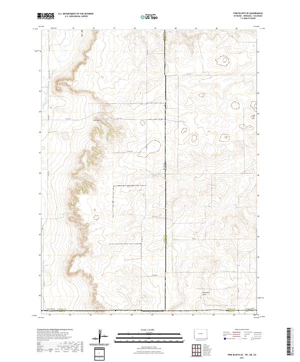
2021 Map of Pine Bluffs SE
USGS Topo · Published 2021About this map
Pine Bluffs serves as the dominant terrain feature on this high plains landscape, situated at the intersection of three western states. This 2021 survey documents the complex tri-state border where Wyoming, Nebraska, and Colorado converge. The topography is defined by the escarpments of the bluffs and the presence of Panorama Point in the southeastern portion of the map, which marks the highest natural point in Nebraska. Water sources are sparse across this arid range, limited primarily to Muddy Cr and Spring Cr in the northwest. The land is divided by a rigorous grid of section lines and county roads, including Black Hills Rd, reflecting the enduring impact of the Public Land Survey System on the development of these borderlands.
Find a feature on this map
24 named features on this map. Tap any name to fly to it.
Don’t see what you’re looking for? This feature index may not catch every label — zoom into the map to look around manually.
Map Details
Editions of this 2021 Pine Bluffs SE Map
This is the sole edition of this map. No revisions or reprints were ever made.
Other maps of this area

1954 · Sterling
USGS Topo · 1:250,000

1954 · Scottsbluff
USGS Topo · 1:250,000

1954 · Cheyenne
USGS Topo · 1:250,000

1954 · Greeley
USGS Topo · 1:250,000

1957 · Greeley
USGS Topo · 1:250,000

1958 · Cheyenne
USGS Topo · 1:250,000

1958 · Greeley
USGS Topo · 1:250,000

1958 · Scottsbluff
USGS Topo · 1:250,000

1958 · Sterling
USGS Topo · 1:250,000

1961 · Greeley
USGS Topo · 1:250,000