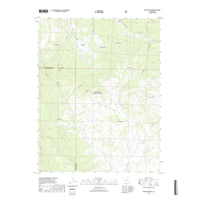
2019 Map of Pine Cone Knob
USGS Topo · Published 2019About this map
Rio Grande National Forest dominates this high-country landscape along the border of Saguache and Rio Grande counties. The terrain is defined by dramatic geological markers such as Cathedral Rock and Cyclone Mtn, while natural open spaces like La Garita Park and Groundhog Park provide breaks in the forested slopes. This 2019 survey documents a complex network of alpine drainages including La Garita Creek and Embargo Creek, illustrating the natural water sources that have historically supported seasonal grazing and forest management. Named points of interest such as Milk Cow Pass and High Spring suggest the historical routes used by ranchers and outdoorsmen moving through the high elevations of the San Juan Mountains.
Find a feature on this map
36 named features on this map. Tap any name to fly to it.
Don’t see what you’re looking for? This feature index may not catch every label — zoom into the map to look around manually.
Map Details
Editions of this 2019 Pine Cone Knob Map
This is the sole edition of this map. No revisions or reprints were ever made.
Other maps of this area

1914 · Creede
USGS Topo · 1:125,000

1915 · Del Norte
USGS Topo · 1:125,000

1916 · Creede
USGS Topo · 1:125,000

1917 · Del Norte
USGS Topo · 1:125,000

1945 · Durango
USGS Topo · 1:250,000

1953 · Durango
USGS Topo · 1:250,000

1954 · Durango
USGS Topo · 1:250,000

1961 · Durango
USGS Topo · 1:250,000

1963 · Durango
USGS Topo · 1:250,000

1966 · Durango
USGS Topo · 1:250,000