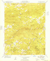
1949 Map of Pine Grove
USGS Topo · Published 1949About this map
Volcano and the surrounding Gold Country ridges of Amador County appear here in detail just after the late 1940s. The map illustrates a landscape transitioning from its deep mining roots toward modern state management, evidenced by the presence of the Mt Zion State Forest and its Mt Zion Lookout. The central portion of the sheet is dominated by the winding paths of Rancheria Creek and Sutter Creek, while the southern reaches contain the Jackson Indian Rancheria and the California Youth Authority facility.
Find a feature on this map
28 named features on this map. Tap any name to fly to it.
Don’t see what you’re looking for? This feature index may not catch every label — zoom into the map to look around manually.
Map Details
Editions of this 1949 Pine Grove Map
This is the sole edition of this map. No revisions or reprints were ever made.
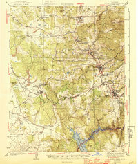
Other maps of this area

1889 · Jackson
USGS Topo · 1:125,000

1891 · Placerville
USGS Topo · 1:125,000

1892 · Jackson
USGS Topo · 1:125,000

1892 · Placerville
USGS Topo · 1:125,000

1893 · Placerville
USGS Topo · 1:125,000

1897 · Jackson
USGS Topo · 1:125,000

1902 · Jackson
USGS Topo · 1:125,000
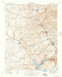
1941 · Sutter Creek
USGS Topo · 1:62,500
1944 · Sutter Creek
USGS Topo · 1:62,500

1947 · Sacramento
USGS Topo · 1:250,000