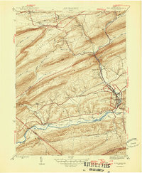
1946 Map of Pine Grove
USGS Topo · Published 1946About this map
Pine Grove and its surrounding valleys are defined by the convergence of heavy industry and natural ridges in this mid-century portrait of Schuylkill County. The Reading railroad network dominates the landscape, weaving through gaps in Sharp Mountain and Second Mountain to serve coal-era settlements like Keffers, Joliett, and Lorberry Junc Ravine PO. The industrial character of the north contrasts with the southern Pine Grove Valley, where small rural schools such as Outwood Sch and Irving Sch emphasize a more dispersed agricultural pattern. Near the southern border, the Appalachian Trail follows the crest of Blue Mtn, while the Swatara Valley Airport sits on the floor of the valley, illustrating the era's evolving transportation needs. This 1946 document preserves the exact placement of local landmarks like Jacobs Ch and the Fire Tower atop Broad Mountain before modern development altered these small Pennsylvania communities.
Find a feature on this map
53 named features on this map. Tap any name to fly to it.
Don’t see what you’re looking for? This feature index may not catch every label — zoom into the map to look around manually.
Map Details
Editions of this 1946 Pine Grove Map
2 editions found
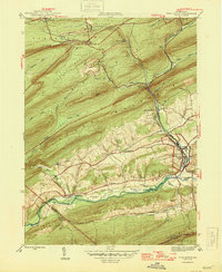
Other maps of this area

1891 · Lebanon
USGS Topo · 1:62,500

1892 · Lykens
USGS Topo · 1:62,500

1892 · Hummelstown
USGS Topo · 1:62,500

1892 · Pine Grove
USGS Topo · 1:62,500

1893 · Lykens
USGS Topo · 1:62,500

1893 · Lebanon
USGS Topo · 1:62,500

1899 · Lebanon
USGS Topo · 1:62,500

1924 · Hummelstown
USGS Topo · 1:62,500

1943 · Lebanon
USGS Topo · 1:62,500

1943 · Lykens
USGS Topo · 1:62,500
Featured Places
- Bethel Township, PA
- Hegins Township, PA
- Pine Grove, Pine Grove Township
- Union Township, PA
- Tremont Township, PA