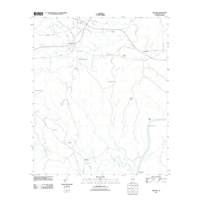
2011 Map of Pine Hill
USGS Topo · Published 2011About this map
Pine Hill sits as a central hub in Wilcox County, where local roads like Old Selma Rd and County Rd 27 converge amidst a landscape deeply carved by river tributaries. This 2011 survey reveals a territory marked by numerous burial sites, including Saint Johns Cemetery, Enon Cemetery, and Shamburger Cemetery, indicating a long-standing pattern of rural family settlements. To the east, the Alabama River defines the border, punctuated by historic access points such as Yellow Bluff Landing and Etta Landing. The terrain is defined by an extensive network of waterways like Beaver Creek and Tiger Creek that flow through the lowlands toward the river, while the Pine Hill Municipal Airport and the small communities of MacMillan and Culpeper show the modern footprint of transportation and habitation in this river-and-creek country.
Find a feature on this map
61 named features on this map. Tap any name to fly to it.
Don’t see what you’re looking for? This feature index may not catch every label — zoom into the map to look around manually.
Map Details
Editions of this 2011 Pine Hill Map
This is the sole edition of this map. No revisions or reprints were ever made.
Other maps of this area

1953 · Montgomery
USGS Topo · 1:250,000

1953 · Andalusia
USGS Topo · 1:250,000

1956 · Montgomery
USGS Topo · 1:250,000

1957 · Montgomery
USGS Topo · 1:250,000

1957 · Andalusia
USGS Topo · 1:250,000

1973 · Coy
USGS Topo · 1:24,000

1973 · Fulton East
USGS Topo · 1:24,000

1973 · Hybart
USGS Topo · 1:24,000

1973 · Pine Hill
USGS Topo · 1:24,000

1973 · Thomasville
USGS Topo · 1:24,000