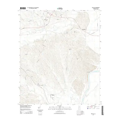
2014 Map of Pine Hill
USGS Topo · Published 2014About this map
Pine Hill serves as a central hub for this portion of Wilcox County, where several local roads such as Old Selma Rd and Broad St converge. The landscape is defined by the winding course of the Alabama River and Claiborne Lake along its eastern edge, a region marked by the high ground of Yellow Bluff. The interior is heavily dissected by numerous creek systems, including Beaver Cr, Bailey Cr, and Tiger Cr, which carve through the terrain and influence the placement of rural homesteads and settlements like MacMillan and Culpeper. This survey is particularly useful for genealogical research, documenting an unusually high density of family and community burial sites such as Shamburger Cem, Mt Andrew Cem, and Saint Johns Cem tucked away among the many drainages and ridge lines.
Find a feature on this map
57 named features on this map. Tap any name to fly to it.
Don’t see what you’re looking for? This feature index may not catch every label — zoom into the map to look around manually.
Map Details
Editions of this 2014 Pine Hill Map
This is the sole edition of this map. No revisions or reprints were ever made.
Other maps of this area

1953 · Montgomery
USGS Topo · 1:250,000

1953 · Andalusia
USGS Topo · 1:250,000

1956 · Montgomery
USGS Topo · 1:250,000

1957 · Montgomery
USGS Topo · 1:250,000

1957 · Andalusia
USGS Topo · 1:250,000

1973 · Coy
USGS Topo · 1:24,000

1973 · Fulton East
USGS Topo · 1:24,000

1973 · Hybart
USGS Topo · 1:24,000

1973 · Pine Hill
USGS Topo · 1:24,000

1973 · Thomasville
USGS Topo · 1:24,000