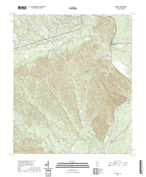
2024 Map of Pine Hill
USGS Topo · Published 2024About this map
The Alabama River flows along the eastern edge of this Wilcox County landscape, defining the topography of the Black Belt region. The settlement of Pine Hill serves as a local hub in the northwest, where a concentration of historical sites like Pine Hill Cem and Enon Cem provides a focal point for genealogical research. The terrain is deeply etched by a network of waterways, including Beaver Creek and Tiger Creek, which move through the low-lying areas between MacMillan and Culpeper.
Find a feature on this map
64 named features on this map. Tap any name to fly to it.
Don’t see what you’re looking for? This feature index may not catch every label — zoom into the map to look around manually.
Map Details
Editions of this 2024 Pine Hill Map
This is the sole edition of this map. No revisions or reprints were ever made.
Other maps of this area

1953 · Montgomery
USGS Topo · 1:250,000

1953 · Andalusia
USGS Topo · 1:250,000

1956 · Montgomery
USGS Topo · 1:250,000

1957 · Montgomery
USGS Topo · 1:250,000

1957 · Andalusia
USGS Topo · 1:250,000

1973 · Coy
USGS Topo · 1:24,000

1973 · Fulton East
USGS Topo · 1:24,000

1973 · Hybart
USGS Topo · 1:24,000

1973 · Pine Hill
USGS Topo · 1:24,000

1973 · Thomasville
USGS Topo · 1:24,000