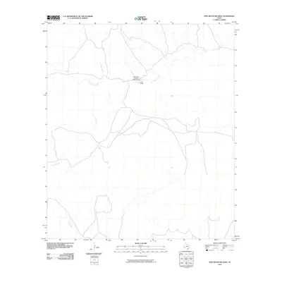
2010 Map of Pine Mountain West
USGS Topo · Published 2010About this map
San Francisco Creek and its seasonal tributaries carve a network of drainages through this remote Brewster County landscape. The area is defined by large-scale ranching operations, centered on the Gage Ranch and its associated infrastructure. The presence of the Chaney San Francisco Ranch Airport indicates the reliance on private aviation for connectivity in this isolated West Texas region. The drainage patterns of Rough Creek, Bear Creek, and Kincaid Creek dictate the local geography, showing how water sources and natural topography influenced the placement of ranch roads and homesteads in this arid environment during the early 21st century.
Find a feature on this map
6 named features on this map. Tap any name to fly to it.
Don’t see what you’re looking for? This feature index may not catch every label — zoom into the map to look around manually.
Map Details
Editions of this 2010 Pine Mountain West Map
This is the sole edition of this map. No revisions or reprints were ever made.
Other maps of this area

1917 · Hood Spring
USGS Topo · 1:62,500

1918 · Bone Spring
USGS Topo · 1:125,000

1918 · Hood Spring
USGS Topo · 1:62,500

1918 · Dove Mountain
USGS Topo · 1:62,500

1920 · Longfellow
USGS Topo · 1:125,000

1920 · Marathon
USGS Topo · 1:62,500

1921 · Marathon
USGS Topo · 1:62,500

1931 · Hood Spring
USGS Topo · 1:62,500

1954 · Fort Stockton
USGS Topo · 1:250,000

1958 · Fort Stockton
USGS Topo · 1:250,000