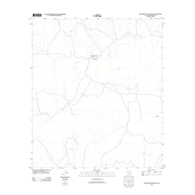
2013 Map of Pine Mountain West
USGS Topo · Published 2013About this map
Gage Ranch and the nearby Chaney San Francisco Ranch Airport anchor this high-desert landscape in Brewster County. The map is defined by a dendritic network of ephemeral waterways that carve through the terrain, most notably the winding course of San Francisco Cr. These drainages, including Rough Cr, Bear Cr, and Kincaid Cr, trace the natural hydrology of the region toward the Rio Grande basin. In the southeastern portion of the quadrangle, Pine Mtn stands as a primary landmark. The map documents a sparsely populated ranching environment where development is limited to isolated homesteads and private airstrips, reflecting the continued reliance on large-scale land holdings and traditional livestock operations characteristic of the Big Bend region in the early twenty-first century.
Find a feature on this map
7 named features on this map. Tap any name to fly to it.
Don’t see what you’re looking for? This feature index may not catch every label — zoom into the map to look around manually.
Map Details
Editions of this 2013 Pine Mountain West Map
This is the sole edition of this map. No revisions or reprints were ever made.
Other maps of this area

1917 · Hood Spring
USGS Topo · 1:62,500

1918 · Bone Spring
USGS Topo · 1:125,000

1918 · Hood Spring
USGS Topo · 1:62,500

1918 · Dove Mountain
USGS Topo · 1:62,500

1920 · Longfellow
USGS Topo · 1:125,000

1920 · Marathon
USGS Topo · 1:62,500

1921 · Marathon
USGS Topo · 1:62,500

1931 · Hood Spring
USGS Topo · 1:62,500

1954 · Fort Stockton
USGS Topo · 1:250,000

1958 · Fort Stockton
USGS Topo · 1:250,000