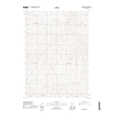
2017 Map of Pine Ridge NE
USGS Topo · Published 2017About this map
Grass Creek and Little Grass Creek carve through the expansive drainage basins of Oglala Lakota County in this modern topographic survey. The landscape is defined by the sharp dissected plateaus and coulees characteristic of this part of South Dakota, where watercourses like Pepper Creek dictate the local topography. This map highlights the rural road network within the Pine Ridge Reservation, specifically focusing on White Horse Creek Rd as it traverses the southern sections. The map provides a detailed view of the Public Land Survey System grid, including the intersection of Township 37 North and Range 44 West, illustrating how the legal boundaries of the plains overlay the natural undulating terrain of the creek valleys.
Find a feature on this map
10 named features on this map. Tap any name to fly to it.
Don’t see what you’re looking for? This feature index may not catch every label — zoom into the map to look around manually.
Map Details
Editions of this 2017 Pine Ridge NE Map
This is the sole edition of this map. No revisions or reprints were ever made.
Other maps of this area

1951 · Rockyford SW
USGS Topo · 1:24,000

1951 · Rockyford SE
USGS Topo · 1:24,000

1955 · Hot Springs
USGS Topo · 1:250,000

1967 · Pine Ridge SW
USGS Topo · 1:24,000

1967 · Pine Ridge NE
USGS Topo · 1:24,000

1967 · Pine Ridge
USGS Topo · 1:24,000

1967 · Manderson
USGS Topo · 1:24,000

1967 · Oglala
USGS Topo · 1:24,000

1967 · Manderson SW
USGS Topo · 1:24,000

1981 · Evergreen
USGS Topo · 1:25,000