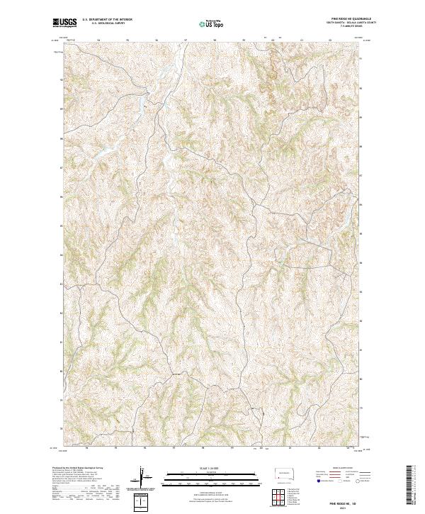
2021 Map of Pine Ridge NE
USGS Topo · Published 2021About this map
Little Grass Creek and Grass Creek weave through this section of Oglala Lakota County, defining the drainage patterns of a landscape segmented by the Public Land Survey System. The map traces the natural watercourses through various townships, including t38n r45w and t37n r44w, illustrating the intersection of natural topography and administrative boundaries. Unlike many areas with dense town centers, this region is characterized by its open drainages and the winding path of Pepper Creek in the eastern portion. The only major named transit corridor is White Horse Creek Rd, which cuts across the lower southeastern corner, providing a vital connection through the undulating terrain. This 2021 survey offers a clear view of the hydrological network and road access within the Pine Ridge area, useful for studying modern land use and natural water flow in the northern Great Plains.
Find a feature on this map
10 named features on this map. Tap any name to fly to it.
Don’t see what you’re looking for? This feature index may not catch every label — zoom into the map to look around manually.
Map Details
Editions of this 2021 Pine Ridge NE Map
This is the sole edition of this map. No revisions or reprints were ever made.
Other maps of this area

1951 · Rockyford SW
USGS Topo · 1:24,000

1951 · Rockyford SE
USGS Topo · 1:24,000

1955 · Hot Springs
USGS Topo · 1:250,000

1967 · Pine Ridge SW
USGS Topo · 1:24,000

1967 · Pine Ridge NE
USGS Topo · 1:24,000

1967 · Pine Ridge
USGS Topo · 1:24,000

1967 · Manderson
USGS Topo · 1:24,000

1967 · Oglala
USGS Topo · 1:24,000

1967 · Manderson SW
USGS Topo · 1:24,000

1981 · Evergreen
USGS Topo · 1:25,000