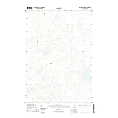
2014 Map of Pine Stream Flowage
USGS Topo · Published 2014About this map
Pine Stream Flowage dominates this northern Piscataquis County landscape, where the waters of Pine Stream gather before flowing toward Chesuncook Lake. The terrain is defined by a dense network of remote waterways and ponds, including the centrally located Grassy Pond and the larger Salmon Pond to the west. This area is characterized by its isolation and limited access, with forestry and transport corridors like the Golden Rd and Salmon Pond Rd providing the primary routes through the timberlands. The hydrological pattern of small, interconnected bodies of water such as Shack Pond, Round Pond, and Little Lobster Lake reflects the glacial legacy of the North Maine Woods, where seasonal flowages like these were historically vital for log drives and remain essential for modern conservation and recreational use.
Find a feature on this map
20 named features on this map. Tap any name to fly to it.
Don’t see what you’re looking for? This feature index may not catch every label — zoom into the map to look around manually.
Map Details
Editions of this 2014 Pine Stream Flowage Map
This is the sole edition of this map. No revisions or reprints were ever made.
Other maps of this area

1954 · Chesuncook
USGS Topo · 1:62,500

1954 · North East Carry
USGS Topo · 1:62,500

1954 · Caucomgomoc Lake
USGS Topo · 1:62,500

1954 · Grant Farm
USGS Topo · 1:62,500

1954 · Presque Isle
USGS Topo · 1:250,000

1954 · Millinocket
USGS Topo · 1:250,000

1958 · Presque Isle
USGS Topo · 1:250,000

1958 · Millinocket
USGS Topo · 1:250,000

1958 · Chesuncook
USGS Topo · 1:62,500

1958 · Caucomgomoc Lake
USGS Topo · 1:62,500