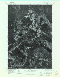
1977 Map of Pine Stream Flowage
USGS Topo · Published 1981About this map
Pine Stream carves a winding path through this North Woods landscape, creating a complex network of wetlands and seasonal water levels known as the Pine Stream Flowage. This 1977 orthophotoquad provides an unfiltered view of the Maine wilderness, capturing the density of the forest canopy and the distinct shorelines of several remote water bodies. The terrain is defined by isolated basins such as Salmon Pond and Deer Pond, which sit as quiet markers within the timberland.
Find a feature on this map
6 named features on this map. Tap any name to fly to it.
Don’t see what you’re looking for? This feature index may not catch every label — zoom into the map to look around manually.
Map Details
Editions of this 1977 Pine Stream Flowage Map
This is the sole edition of this map. No revisions or reprints were ever made.
Other maps of this area

1954 · Chesuncook
USGS Topo · 1:62,500

1954 · North East Carry
USGS Topo · 1:62,500

1954 · Caucomgomoc Lake
USGS Topo · 1:62,500

1954 · Grant Farm
USGS Topo · 1:62,500

1954 · Presque Isle
USGS Topo · 1:250,000

1954 · Millinocket
USGS Topo · 1:250,000

1958 · Presque Isle
USGS Topo · 1:250,000

1958 · Millinocket
USGS Topo · 1:250,000

1958 · Chesuncook
USGS Topo · 1:62,500

1958 · Caucomgomoc Lake
USGS Topo · 1:62,500