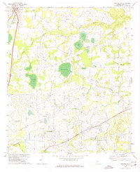
1971 Map of Pineview NW
USGS Topo · Published 1974About this map
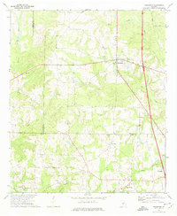
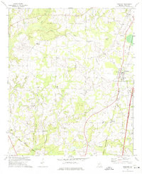
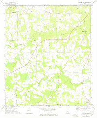
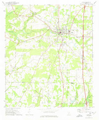
The town of Unadilla serves as a northern anchor for this landscape, where the Southern RR cuts through the rural terrain of Dooly County. The area is defined by a series of named water bodies and creek systems, including the uniquely named Alligator Pond, Layfield Pond, and Pocosin Pond. These basins are fed by networks like South Prong Creek and Wallace Branch, creating a low-lying geography that influenced the placement of early infrastructure. Rural social centers are well-documented through a series of country churches, such as Mt Moriah Ch and Smyrna Ch, which often sit adjacent to local cemeteries. Transportation and utility features like Posey Airport, various unnamed landing strips, and a Sewage Disposal site north of the main settlement reflect the mid-century development of the region's municipal and aviation services.
Find a feature on this map
24 named features on this map. Tap any name to fly to it.
Don’t see what you’re looking for? This feature index may not catch every label — zoom into the map to look around manually.
Map Details
Editions of this 1971 Pineview NW Map
2 editions found

Other maps of this area
1956 · Perry
USGS Topo · 1:62,500

1957 · Macon
USGS Topo · 1:250,000

1958 · Macon
USGS Topo · 1:250,000

1964 · Macon
USGS Topo · 1:250,000
1971 · Pineview West
USGS Topo · 1:24,000
1971 · Pineview SW
USGS Topo · 1:24,000
1971 · Henderson
USGS Topo · 1:24,000
1971 · Pinehurst
USGS Topo · 1:24,000
1972 · Finleyson West
USGS Topo · 1:24,000
1972 · Vienna
USGS Topo · 1:24,000