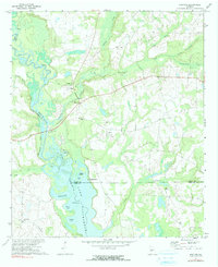
1972 Map of Drayton
USGS Topo · Published 1991About this map
Lake Blackshear and the winding Flint River dominate this 1970s landscape, marking the convergence of Dooly, Sumter, and Crisp Counties. The map reveals a complex riverine environment where the water gives way to distinct features like Whisky Island, the Glory Hole, and Parkers Slough. These swampy lowlands are contrasted by the established rural communities on higher ground, centered around Drayton and Lilly.
Find a feature on this map
29 named features on this map. Tap any name to fly to it.
Don’t see what you’re looking for? This feature index may not catch every label — zoom into the map to look around manually.
Map Details
Editions of this 1972 Drayton Map
2 editions found

Other maps of this area

1953 · Dothan
USGS Topo · 1:250,000

1953 · Waycross
USGS Topo · 1:250,000

1954 · Dothan
USGS Topo · 1:250,000

1955 · Dothan
USGS Topo · 1:250,000

1955 · Phenix City
USGS Topo · 1:250,000

1956 · Leslie
USGS Topo · 1:62,500

1957 · Phenix City
USGS Topo · 1:250,000

1957 · Macon
USGS Topo · 1:250,000

1958 · Macon
USGS Topo · 1:250,000

1958 · Phenix City
USGS Topo · 1:250,000