
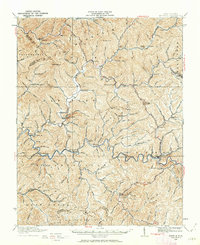
1910 Map of Pineville
USGS Topo · Published 1910About this map
The Guyandot River winds through the heart of Wyoming County, defining a landscape dominated by steep ridges and narrow hollows. In this early century survey, Pineville serves as a focal point near the prominent Pinnacle landmark and the convergence of Barkers Ridge. The map illustrates a network of small settlements and post offices like Baileysville, Oceana, and Rockview connected by early transport routes labeled as the Upper Road and Lower Road.
Find a feature on this map
166 named features on this map. Tap any name to fly to it.
Don’t see what you’re looking for? This feature index may not catch every label — zoom into the map to look around manually.
Map Details
Editions of this 1910 Pineville Map
2 editions found
Other maps of this area

1887 · Pocahontas
USGS Topo · 1:125,000

1891 · Tazewell
USGS Topo · 1:125,000

1891 · Pocahontas
USGS Topo · 1:125,000

1891 · Oceana
USGS Topo · 1:125,000

1891 · Raleigh
USGS Topo · 1:125,000

1893 · Oceana
USGS Topo · 1:125,000

1894 · Pocahontas
USGS Topo · 1:125,000

1895 · Tazewell
USGS Topo · 1:125,000

1895 · Pocahontas
USGS Topo · 1:125,000

1897 · Tazewell
USGS Topo · 1:125,000