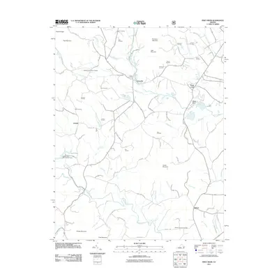
2011 Map of Piney River
USGS Topo · Published 2011About this map
Lowesville sits at the convergence of several rural corridors, including Lowesville Rd and Dickie Rd, serving as a central point in this landscape defined by the drainage of the Piney River and Buffalo River. The topography is marked by several prominent peaks such as Turkey Mountain and Mobley Mountain, while the valleys between them are dotted with numerous family burial grounds. Researchers will find a high density of genealogical sites, including the Mays Cemetery, Steele Cemetery, and Loving Cemetery. Significant water management features are present, such as Buffalo River Dam Number Three, indicating the engineered nature of the river system. Aviation history is represented by the Fulcher Family Farms Airport, tucked north of Indian Creek. The area around Clifford and Shady Lane shows a transition toward more open terrain near the Winton Country Club Dam.
Find a feature on this map
84 named features on this map. Tap any name to fly to it.
Don’t see what you’re looking for? This feature index may not catch every label — zoom into the map to look around manually.
Map Details
Editions of this 2011 Piney River Map
This is the sole edition of this map. No revisions or reprints were ever made.
Other maps of this area

1892 · Buckingham
USGS Topo · 1:125,000

1894 · Lexington
USGS Topo · 1:125,000

1935 · Amherst
USGS Topo · 1:48,000

1936 · Vesuvius
USGS Topo · 1:48,000

1939 · Amherst
USGS Topo · 1:62,500

1941 · Vesuvius
USGS Topo · 1:62,500

1943 · Lovingston
USGS Topo · 1:62,500

1946 · Lovingston
USGS Topo · 1:62,500

1947 · Roanoke
USGS Topo · 1:250,000

1950 · Amherst
USGS Topo · 1:62,500