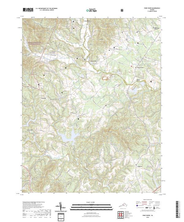
2022 Map of Piney River
USGS Topo · Published 2022About this map
Lowesville and Piney River anchor this central Virginia landscape where the George Washington National Forest meets the foothills of the Blue Ridge. The geography is defined by a dense network of watercourses, including the Little Piney River and the Buffalo River, which carve through prominent elevations like Turkey Mtn and Mobley Mtn. Genealogists will find a significant concentration of family-named burial sites scattered throughout the terrain, such as Henley Cem, Mays Cem, and the Fulcher Cem near the Fulcher Family Farms Airport. The transition from forest to settlement is visible in the network of rural routes like State Rte 629 and the repurposing of industrial infrastructure, evidenced by the Blue Ridge Railway Trl following the river through Shady Lane.
Find a feature on this map
122 named features on this map. Tap any name to fly to it.
Don’t see what you’re looking for? This feature index may not catch every label — zoom into the map to look around manually.
Map Details
Editions of this 2022 Piney River Map
This is the sole edition of this map. No revisions or reprints were ever made.
Other maps of this area

1892 · Buckingham
USGS Topo · 1:125,000

1894 · Lexington
USGS Topo · 1:125,000

1935 · Amherst
USGS Topo · 1:48,000

1936 · Vesuvius
USGS Topo · 1:48,000

1939 · Amherst
USGS Topo · 1:62,500

1941 · Vesuvius
USGS Topo · 1:62,500

1943 · Lovingston
USGS Topo · 1:62,500

1946 · Lovingston
USGS Topo · 1:62,500

1947 · Roanoke
USGS Topo · 1:250,000

1950 · Amherst
USGS Topo · 1:62,500