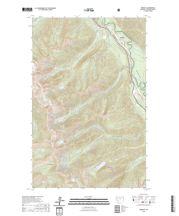
2024 Map of Pinnacle
USGS Topo · Published 2024About this map
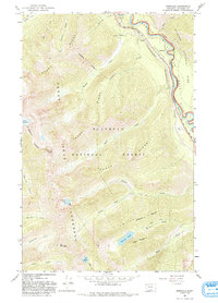
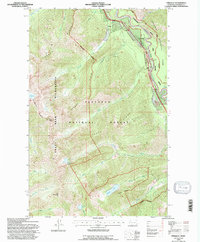
Pinnacle is situated at a critical mountain juncture where the Middle Fork Flathead River carves through the John F Stevens Canyon. This landscape is defined by the sharp transition between the Flathead National Forest and Glacier National Park, with the Great Bear Wilderness protecting the high ridgelines of the Flathead Range to the southwest. The presence of Theodore Roosevelt Pass signifies the historical importance of this corridor for transcontinental transit through the northern Rockies.
Find a feature on this map
68 named features on this map. Tap any name to fly to it.
Don’t see what you’re looking for? This feature index may not catch every label — zoom into the map to look around manually.
Map Details
Editions of this 2024 Pinnacle Map
This is the sole edition of this map. No revisions or reprints were ever made.
Historical Maps of Pinnacle Through Time
3 maps found