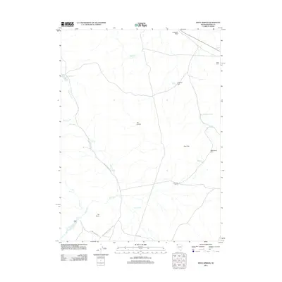
2011 Map of Pinto Springs
USGS Topo · Published 2011About this map
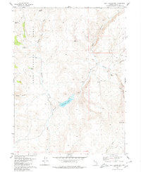
Nolan Ranch stands as a focal point in this high-desert landscape of northwestern Nevada, situated near the winding course of Wall Creek. The area is defined by a critical network of water sources, essential for survival and livestock in this arid environment. Named springs such as Pinto Springs, Pick and Shovel Spring, and Lope Spring are scattered across the terrain, alongside improvements like the Wall Canyon Windmill. The map reveals a system of unpaved roads, including Boulder Reservoir Rd and Chester Rd, which navigate between prominent landforms like The Buttes and Pinto Peak. To the north, the elevation rises toward Crabapple Ridge, while Black Rock Reservoir and Boulder Reservoir mark rare instances of surface water storage. This 2011 survey documents a sparsely populated but active range, where geographic naming conventions reflect both the local wildlife and the utilitarian needs of ranching.
Find a feature on this map
24 named features on this map. Tap any name to fly to it.
Don’t see what you’re looking for? This feature index may not catch every label — zoom into the map to look around manually.
Map Details
Editions of this 2011 Pinto Springs Map
This is the sole edition of this map. No revisions or reprints were ever made.
Other maps of this area

1889 · Long Valley
USGS Topo · 1:250,000

1954 · Vya
USGS Topo · 1:250,000

1958 · Vya
USGS Topo · 1:250,000

1962 · Vya
USGS Topo · 1:250,000

1978 · Hart Mountain
USGS Topo · 1:24,000
1979 · Powers Well
USGS Topo · 1:24,000
1979 · Nellie Spring Mtn
USGS Topo · 1:24,000
1979 · Boulder Lake
USGS Topo · 1:24,000
1979 · Wall Canyon Reservoir
USGS Topo · 1:24,000
1979 · Boulder Mtn.
USGS Topo · 1:24,000