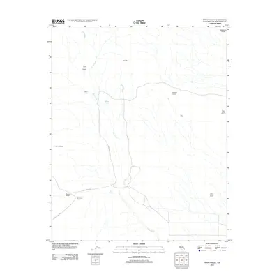
2012 Map of Pinto Valley
USGS Topo · Published 2012About this map
Watson Wash meanders through this portion of San Bernardino County, carving a path between the elevated terrain of Drum Peak and Pinto Mountain. This high desert landscape is defined by its seasonal water sources and early travel routes, featuring the historic Government Holes and Rock Spring which served as critical watering points for travelers and livestock. The area's ranching heritage is evidenced by the presence of Wire Corrals, Lower Caruthers Corrals, and the Ross Horse Pasture.
Find a feature on this map
19 named features on this map. Tap any name to fly to it.
Don’t see what you’re looking for? This feature index may not catch every label — zoom into the map to look around manually.
Map Details
Editions of this 2012 Pinto Valley Map
This is the sole edition of this map. No revisions or reprints were ever made.
Other maps of this area

1910 · Ivanpah
USGS Topo · 1:250,000

1912 · Ivanpah
USGS Topo · 1:250,000

1942 · Ivanpah
USGS Topo · 1:250,000

1947 · Kingman
USGS Topo · 1:250,000

1948 · Kingman
USGS Topo · 1:250,000

1954 · Kingman
USGS Topo · 1:250,000

1955 · Kingman
USGS Topo · 1:250,000

1955 · Mid Hills
USGS Topo · 1:62,500
1956 · Lanfair Valley
USGS Topo · 1:62,500

1956 · Ivanpah
USGS Topo · 1:62,500