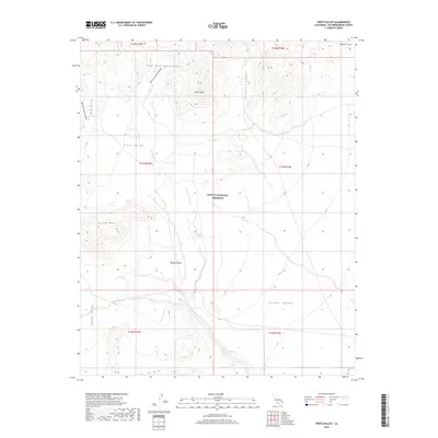
2018 Map of Pinto Valley
USGS Topo · Published 2018About this map
The New York Mountains dominate the northern terrain of this 2018 survey within the Mojave National Preserve. This landscape is characterized by a high-desert drainage system including Watson Wash, which flows through the namesake Pinto Valley toward the lower reaches of the Mojave Desert. Notable landmarks for navigation and survival in this arid environment include Rock Spring, Howe Spring, and Martin Pond, which serve as vital markers amidst the surrounding peaks like Drum Peak and Pinto Mtn. The map documents the complex topography where Caruthers Canyon and Sagamore Canyon cut through the granite uplands, illustrating the seasonal water pathways that define the local geography. This modern study provides an inventory of named physical features within protected federal lands in eastern San Bernardino County.
Find a feature on this map
23 named features on this map. Tap any name to fly to it.
Don’t see what you’re looking for? This feature index may not catch every label — zoom into the map to look around manually.
Map Details
Editions of this 2018 Pinto Valley Map
This is the sole edition of this map. No revisions or reprints were ever made.
Other maps of this area

1910 · Ivanpah
USGS Topo · 1:250,000

1912 · Ivanpah
USGS Topo · 1:250,000

1942 · Ivanpah
USGS Topo · 1:250,000

1947 · Kingman
USGS Topo · 1:250,000

1948 · Kingman
USGS Topo · 1:250,000

1954 · Kingman
USGS Topo · 1:250,000

1955 · Kingman
USGS Topo · 1:250,000

1955 · Mid Hills
USGS Topo · 1:62,500
1956 · Lanfair Valley
USGS Topo · 1:62,500

1956 · Ivanpah
USGS Topo · 1:62,500