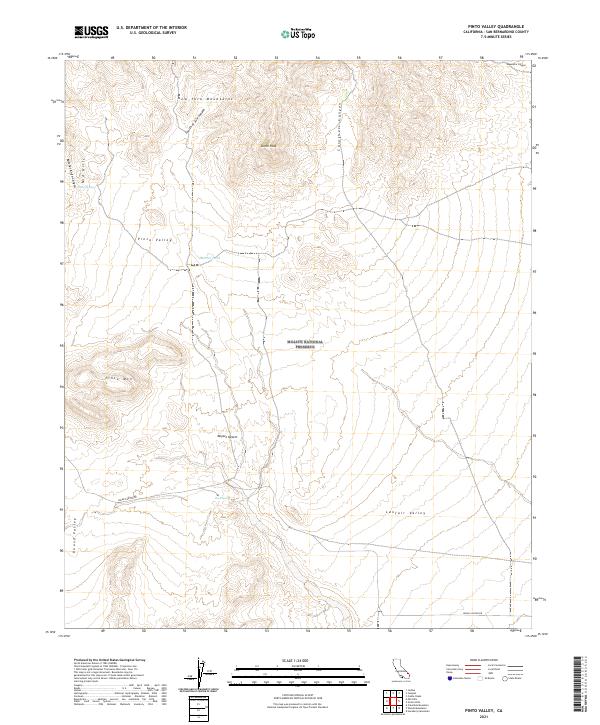
2021 Map of Pinto Valley
USGS Topo · Published 2021About this map
Mojave National Preserve covers the high-elevation desert landscape of this San Bernardino County survey, where water sources like Rock Spring, Howe Spring, and Martin Pond define the survival geography of the region. The map captures a diverse network of landforms, from the towering heights of the New York Mountains and Drum Peak in the north to the expansive Lanfair Valley in the southeast. Evidence of historical travel routes remains centered around Cedar Canyon Rd, which cuts through the heart of the territory. The topography is deeply carved by numerous washes and canyons, including Caruthers Canyon and Butcher Knife Canyon, which drain the Mid Hills and Pinto Valley. This survey preserves the exact placement of specific mountain summits like Pinto Mtn, providing a clear record of the Mojave Desert’s natural landmarks and drainage patterns.
Find a feature on this map
23 named features on this map. Tap any name to fly to it.
Don’t see what you’re looking for? This feature index may not catch every label — zoom into the map to look around manually.
Map Details
Editions of this 2021 Pinto Valley Map
This is the sole edition of this map. No revisions or reprints were ever made.
Other maps of this area

1910 · Ivanpah
USGS Topo · 1:250,000

1912 · Ivanpah
USGS Topo · 1:250,000

1942 · Ivanpah
USGS Topo · 1:250,000

1947 · Kingman
USGS Topo · 1:250,000

1948 · Kingman
USGS Topo · 1:250,000

1954 · Kingman
USGS Topo · 1:250,000

1955 · Kingman
USGS Topo · 1:250,000

1955 · Mid Hills
USGS Topo · 1:62,500
1956 · Lanfair Valley
USGS Topo · 1:62,500

1956 · Ivanpah
USGS Topo · 1:62,500