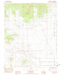
1983 Map of Pinto Valley
USGS Topo · Published 1983About this map
Government Holes stands as a vital landmark in this high desert landscape, marking a historic watering point where the Pinto Valley meets the lower reaches of the New York Mountains. This 1983 provisional survey captures the rugged transition between the northern peaks and the sweeping expanse of Lanfair Valley to the south. The terrain is defined by deep incisions like Caruthers Canyon and Fourth of July Canyon, which channel seasonal runoff toward Watson Wash. Evidence of small-scale mountain industry remains at the Barnett Mine, while vital water sources such as Rock Spring and Howe Spring indicate the essential points of survival in this arid environment. The map details the complex drainage patterns and livestock areas like Ross Horse Pasture, reflecting a late 20th-century landscape still tied to its ranching and prospecting roots.
Find a feature on this map
18 named features on this map. Tap any name to fly to it.
Don’t see what you’re looking for? This feature index may not catch every label — zoom into the map to look around manually.
Map Details
Editions of this 1983 Pinto Valley Map
This is the sole edition of this map. No revisions or reprints were ever made.
Other maps of this area

1910 · Ivanpah
USGS Topo · 1:250,000

1912 · Ivanpah
USGS Topo · 1:250,000

1942 · Ivanpah
USGS Topo · 1:250,000

1947 · Kingman
USGS Topo · 1:250,000

1948 · Kingman
USGS Topo · 1:250,000

1954 · Kingman
USGS Topo · 1:250,000

1955 · Kingman
USGS Topo · 1:250,000

1955 · Mid Hills
USGS Topo · 1:62,500
1956 · Lanfair Valley
USGS Topo · 1:62,500

1956 · Ivanpah
USGS Topo · 1:62,500