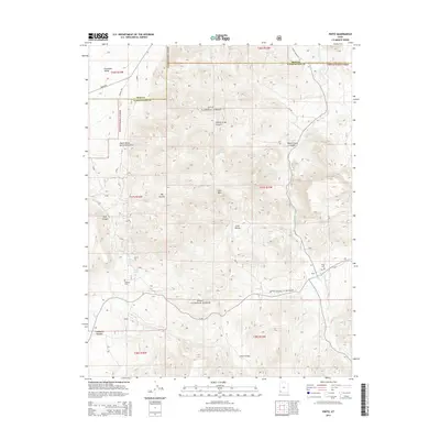
2014 Map of Pinto
USGS Topo · Published 2014About this map
Pinto and the surrounding high desert of Washington County are documented in this 2014 survey, highlighting a landscape defined by pioneer-era history and complex terrain. The map traces the historic Spanish Trl and the path from Mountain Meadows to New Harmon, providing critical spatial context for the region's early transit corridors. Genealogists will find the exact locations of the Pinto Cem and the more remote Hamblin Cem near Hamblin Spring, while the Death Valley Party Monument marks a specific point of western migration history. The drainage of Pinto Cr and numerous water sources like Platt Spring and Oak Spring reveal the precarious water-dependent nature of settlement in this part of the Dixie National Forest. From the depths of Wheat Grass Canyon to the heights of Cove Mtn, the sheet provides a meticulous record of the varied topography north of the Mountain Meadow site.
Find a feature on this map
33 named features on this map. Tap any name to fly to it.
Don’t see what you’re looking for? This feature index may not catch every label — zoom into the map to look around manually.
Map Details
Editions of this 2014 Pinto Map
This is the sole edition of this map. No revisions or reprints were ever made.
Other maps of this area

1885 · St. George
USGS Topo · 1:250,000

1891 · St. George
USGS Topo · 1:250,000

1950 · Iron Mountain
USGS Topo · 1:62,500

1950 · Silver Peak
USGS Topo · 1:24,000

1950 · Page Ranch
USGS Topo · 1:24,000

1951 · Silver Peak
USGS Topo · 1:24,000

1951 · Page Ranch
USGS Topo · 1:24,000

1953 · Cedar City
USGS Topo · 1:250,000

1957 · New Harmony
USGS Topo · 1:62,500

1958 · Cedar City
USGS Topo · 1:250,000