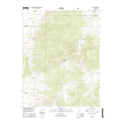
2017 Map of Pinto
USGS Topo · Published 2017About this map
Pinto and the nearby Mountain Meadow lie at the heart of this high-elevation landscape in southern Utah. The map traces the historic path of the Spanish Trl as it winds toward the northwest corner near the Escalante Valley. Genealogists and historians will find significant detail in the presence of the Pinto Cem and Hamblin Cem, alongside landmarks like the Death Valley Party Monument in Holt Canyon. Much of the central terrain is occupied by the protected lands of the Dixie National Forest, dominated by the prominent Cove Mtn. The hydrology of the area is defined by numerous seasonal drainages and essential water sources, including Pinto Cr, Spring Cr, and several named springs such as Hyatt Spring and Cove Spring, which supported early settlement and transit in this arid region.
Find a feature on this map
33 named features on this map. Tap any name to fly to it.
Don’t see what you’re looking for? This feature index may not catch every label — zoom into the map to look around manually.
Map Details
Editions of this 2017 Pinto Map
This is the sole edition of this map. No revisions or reprints were ever made.
Other maps of this area

1885 · St. George
USGS Topo · 1:250,000

1891 · St. George
USGS Topo · 1:250,000

1950 · Iron Mountain
USGS Topo · 1:62,500

1950 · Silver Peak
USGS Topo · 1:24,000

1950 · Page Ranch
USGS Topo · 1:24,000

1951 · Silver Peak
USGS Topo · 1:24,000

1951 · Page Ranch
USGS Topo · 1:24,000

1953 · Cedar City
USGS Topo · 1:250,000

1957 · New Harmony
USGS Topo · 1:62,500

1958 · Cedar City
USGS Topo · 1:250,000