
1906 Map of Pisgah
USGS Topo · Published 1934About this map
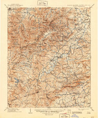
The headwaters of the French Broad River and its major tributaries, such as the Davidson River and Little River, anchor this highland landscape at the dawn of the twentieth century. Centered on the sprawling Pisgah Forest, the map illustrates a network of mountain settlements including Brevard and Waynesville, while the Southern RR provides critical transport through the eastern corridor near Arden. The topography is defined by high-elevation landmarks like Richland Balsam and Toxaway Mt., revealing the early development of Hogback Valley and the various forks of the Pigeon River.
Find a feature on this map
261 named features on this map. Tap any name to fly to it.
Don’t see what you’re looking for? This feature index may not catch every label — zoom into the map to look around manually.
Map Details
Editions of this 1906 Pisgah Map
2 editions found
Other maps of this area

1886 · Walhalla
USGS Topo · 1:125,000

1888 · Pickens
USGS Topo · 1:125,000

1891 · Cowee
USGS Topo · 1:125,000

1892 · Walhalla
USGS Topo · 1:125,000

1893 · Mt Guyot
USGS Topo · 1:125,000

1894 · Asheville
USGS Topo · 1:125,000

1894 · Pickens
USGS Topo · 1:125,000

1896 · Walhalla
USGS Topo · 1:125,000

1897 · Cowee
USGS Topo · 1:125,000

1900 · Mount Mitchell
USGS Topo · 1:125,000